
These photographs, videos, maps, and animations provide information about wind energy resources and the Wind Energy Technologies Office.
Photos
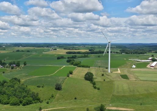
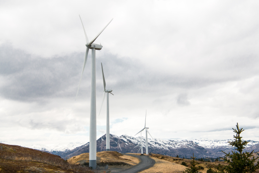
The National Renewable Energy Laboratory's Image Gallery has a collection of wind energy photographs. Additional photographs are also available from the American Wind Energy Association. Distributed wind photographs are available from Pacific Northwest National Laboratory.
Distributed Wind Photo Gallery
For more information about the case studies highlighted this gallery, see the Distributed Wind Photo Gallery page.
Distributed Wind Photo Gallery


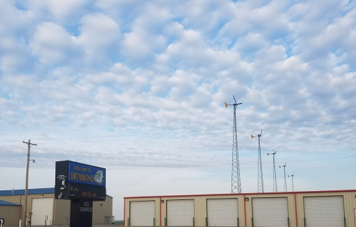


This is an E3120 at a small farm. While Endurance is out of business, folks like Gary Harcourt and Ian Sleger of All Energy Management are busy refurbishing these machines all over the world. Location: Edgartown, Massachusetts
Photo: Gary Harcourt / Great Rock Windpower
February 11, 2025
DOE's "Wind Turbines 101" video explains how wind technologies work and highlights some of the Wind Energy Technologies Office's efforts in R&D in this area.
Tour a Wind Turbine
Atmosphere to Electrons (A2e): Enabling the Wind Plant of Tomorrow
Atmosphere to Electrons (A2e) is a multi-year DOE research initiative targeting significant reductions in the cost of wind energy through an improved understanding of the complex physics governing electricity generation by wind plants. The goal of A2e is to ensure future wind plants are sited, built, and operated in a way that produces the most cost-effective, usable electric power.
America's First Offshore Wind Farm
Transforming Wind Turbine Blade Mold Manufacturing with 3D Printing
Energy by the Numbers: Collegiate Wind Competition
Scaled Wind Farm Technology (SWiFT) Timelapse
Wind Turbine Timelapse
The National Renewable Energy Laboratory installs a 1.5-MW wind turbine at its National Wind Technology Center. Text version.
Wind Vision Videos
Learn more about Wind Vision—the Energy Department's new initiative to revisit the findings of the 2008 DOE 20% Wind Energy by 2030 report and to develop a renewed vision for U.S. wind power research, development, and deployment—by watching the videos below.
Department of Energy Wind Vision: An Industry Preview
The U.S. Department of Energy previewed findings of the Wind Vision report at the American Wind Energy Association’s WINDPOWER conference in May 2014. An earlier industry update from 2013 is also available.
Wind Vision Testimonials
Wind Vision Animated Video
Animations
-
 New animation shows how a wind turbine turns wind energy into electricity using the aerodynamic force from the rotor blades.
 -
 Distributed wind systems are connected on the customer side of the meter to meet the onsite load or directly to distribution or microgrids.
Maps
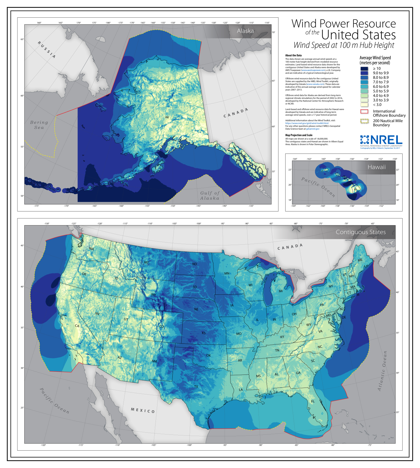
WINDExchange provides wind maps and validation to help homeowners, communities, states and regions consider and plan for wind energy deployment. The maps show the existing wind capacity and the potential wind resources up to 140 meters above ground, including land-based and offshore maps. Read about the available wind maps for utility-, community-, and residential-scale wind development.
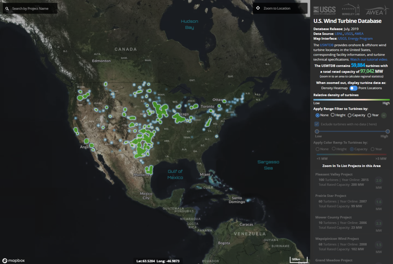
The United States Wind Turbine Database provides a publicly available, spatially referenced, national dataset of wind turbine locations and their corresponding facility information and turbine technical specifications. The project compiled wind turbine information from the Federal Aviation Administration (FAA), Lawrence Berkeley National Laboratory (LBNL), the American Wind Energy Association (AWEA), and United States Geological Survey (USGS) dataset, as well as online sources.
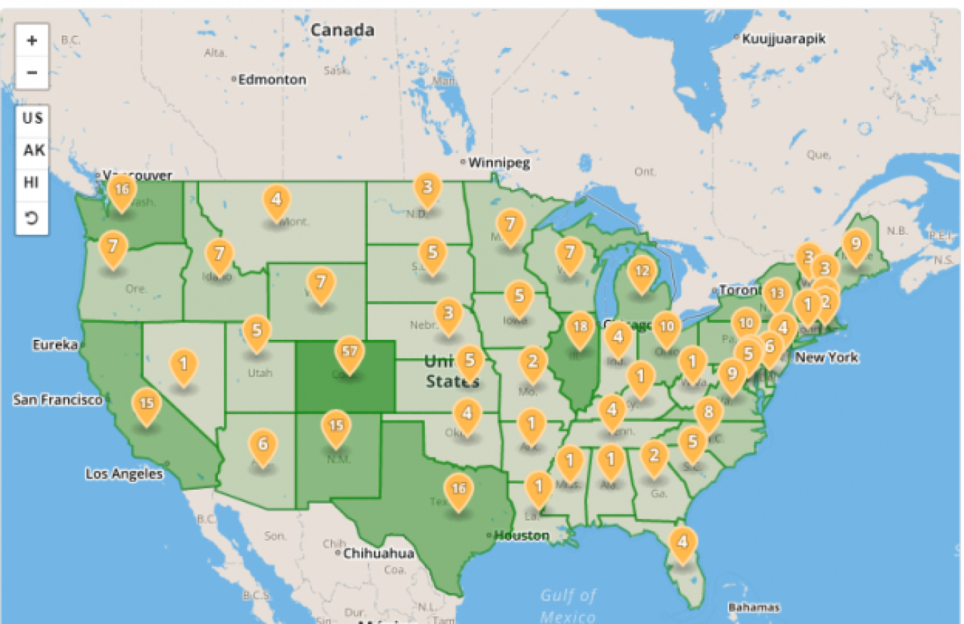
The Wind Energy Technologies Office Projects Map shows the office’s investments in wind research, development, and testing projects across the country.