
New Public Siting Tool Addresses Potential Impacts of Wind Turbines on Radar Systems
Wind Energy Technologies Office
May 17, 2017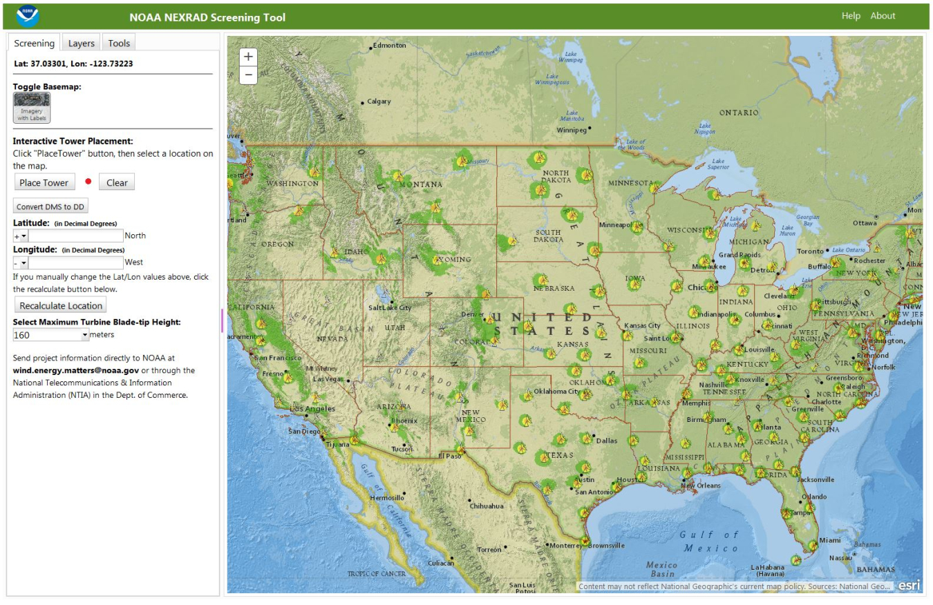
Screenshot of the NOAA's NEXRAD Screening Tool home page. This shows a high-level view of the continental United States with all the NEXRAD systems and their corresponding viewsheds for a default height of 160 meter. Image courtesy of NOAA
As part of the U.S. Department of Energy's (DOE's) effort to address and remove siting barriers for wind energy developments, Sandia National Laboratories (Sandia) has partnered with the National Oceanic and Atmospheric Administration (NOAA) to develop the first publicly available geographic information system (GIS) addressing the potential impacts that wind turbines can have on radar systems—such as impacting weather forecasts and NOAA’s severe weather warning system.

Because Next-Generation Radar (NEXRAD) systems detect wind turbines as they rotate, wind farms can negatively impact weather forecasts and severe weather warnings. NOAA, DOE, and Sandia have developed a screening tool for wind developers, which will obtain a preliminary review of possible weather radar impacts prior to an official Obstruction Evaluation/Airport Airspace Analysis filing. This public tool was developed in part through a strategic partnership project with NOAA and is based on Sandia’s Tool for Siting, Planning, and Encroachment Analysis for Renewables.
NOAA forecasters primarily use NEXRAD—technically known as Weather Surveillance Radar-1988 Doppler—to track weather and make immediate severe weather warning decisions that directly impact public safety. NEXRAD data also support operations of the Federal Aviation Administration’s National Airspace System, U.S. Department of Defense, other government agencies, private industry, and the public.
Users of the online GIS NOAA NEXRAD Screening Tool can place proposed wind turbines at user-selected locations on the map, choosing the turbine’s blade-tip height to visually identify if that turbine is within a defined NOAA weather radar impact zone. The GIS tool provides users with basic measurement and drawing tools to assist with project prospecting and siting.
Also available are NOAA’s NEXRAD and Terminal Doppler Weather Radar zone definitions, NOAA’s “NEXRAD Wind Farm Impact Zone Maps and the Radar Operations Center Evaluation Process” document, and various mapping features—including the NEXRAD radars, the Terminal Doppler Weather Radars, the latest version of the U.S. Geological Survey Wind Turbine Database, and a few basic public mapping layers.
This tool provides first-level feedback to developers and NOAA points of contact who can further analyze impacts and mitigation efforts on NEXRAD weather radars. The use of this tool does not replace the official Federal Aviation Administration process, but rather aids in planning to streamline that process.
In addition to the publicly available tool, current work is underway to develop a NOAA-only tool to replace their existing screening tool, which will be completed by the end of May 2017.
For more information, visit Siting and Barrier Mitigation and NOAA's Radar Operations Center.