
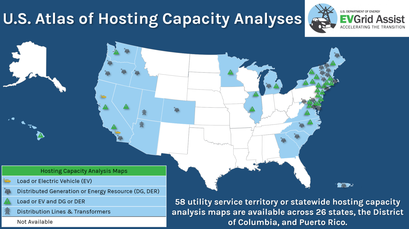
Map of states with at least one public hosting capacity map useful for integrating clean energy into utility distribution systems. As of May 2024, 58 utilities and state agencies have published maps in 26 states, D.C., and Puerto Rico. Shading means that at least one utility within the state has a public hosting capacity map, as noted in Table 2, but does not necessarily indicate complete coverage.
The Benefits of Hosting Capacity Maps
The transition to a more sustainable transportation system—including the widespread adoption of electric vehicles (EVs)—will put new and increased demands on our nation's electricity grids. Electric utilities working to expand their capacity to meet America's future energy needs use hosting capacity maps to provide an overview of a distribution system's ability to host additional electrical capacity (either generation or load) at specific grid locations.
Hosting capacity maps provide greater transparency into the ability of a distribution grid to host additional distributed energy resources (DERs), and including new loads including EV charging. In addition, hosting capacity maps can identify where DERs can alleviate or aggravate grid constraints. Utilities, developers, and other stakeholders can use hosting capacity maps for better planning and siting and they can help businesses like EV charging companies identify where there is available capacity on the electric grid to connect new loads.
While hosting capacity maps do not address site-specific interconnection questions, they can provide a general understanding of a specific network's capacity to accommodate new DERs and some utilities have begun collaborating to provide comprehensive maps covering multiple service territories. And even if a utility does not offer a publicly available hosting capacity map, they may be able to consult with new and existing customers on their distribution network’s future capacity potential.
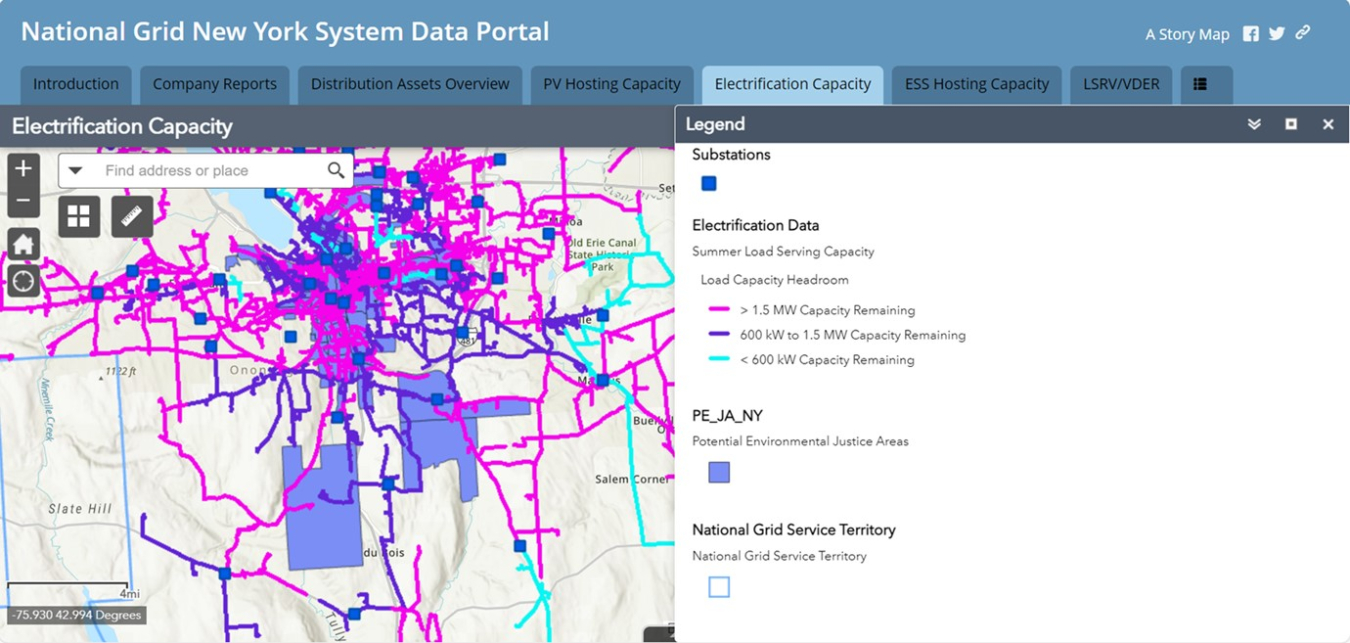
Example of hosting capacity map for EVs, from National Grid's New York System Data Portal.
Note: DOE aggregated this list of publicly available maps for informational purposes only. DOE does not maintain the maps. It is important for users to read the instructions on each hosting capacity map to understand how that map should be used. Users are encouraged to work further with their utilities to determine sites that leverage available grid capacity. To further connect, states, communities, fleets, and developers can use the NEVI U-Finder tool to help find and contact their local utility partners for programs and incentives.
This table will be updated as additional information is made available. Please contact [email protected] for additions and corrections.
Public Hosting Capacity Maps by State and Utility
Updated: May 2024
Other Resources
- NARUC: Grid Data Sharing: Brief Summary of Current State Practices (2023) – Summarizes general trends in regulatory approaches to grid data sharing and outlines key areas of alignment and divergence; a summary table at the end of the document outlines the approaches of different states and utilities.