

 The GeoFlight initiative seeks to capture surface and near-surface geologic data in the Salton Sea region to identify new geothermal energy prospects and areas of highest potential for mineral recovery, especially lithium. It is a joint effort between the Geothermal Technologies Office (GTO) and the Department of the Interior’s U.S. Geological Survey (USGS).
GeoFlight: Salton Trough
GTO and the USGS are collecting data on hidden geothermal systems in California’s agriculturally rich Imperial Valley—the centerpiece of which is the geothermally active Salton Sea area.
- The USGS Earth Mapping Resources Initiative is surveying the Salton Trough area using specially equipped, low-flying aircraft.
- USGS tools actively capture airborne magnetic and radiometric data, identifying unique surface and near-surface characteristics to create more robust exploration tools.
- Understanding these characteristics is essential to responsible and economic geothermal exploration and development.
- The USGS, in cooperation with the Bureau of Land Management and Natural Resources Conservation Service, is also conducting a high-altitude airborne lidar survey over the Salton Sea area. The USGS 3D Elevation Program will provide publicly available, high-quality elevation data for the study area.
GeoFlight builds on the success of the Geophysical Data Acquisition in Western Nevada (GeoDAWN)i GTO-USGS project. Through GeoDAWN and with GTO support, the USGS’s Earth Mapping Resource Initiative conducted surveys that acquired high-resolution airborne magnetic and radiometric dataii over northern and western Nevada and eastern California. These surveys provided key information on surface geology and soil composition, and subsurface structure and geology. Coordinated with this effort and conducted through the USGS 3DEP Program, the collection of airborne lidar data yielded detailed surface topographic models of the terrain over a similar extent spanned by the geophysical surveys. Data collected through GeoDAWN and now GeoFlight provide a deeper understanding of geologic conditions and stress regimes in the Salton Sea region, Walker Lane Trough, and western Great Basin and support geologic and geophysical mapping and modeling for use in geothermal and critical mineral studies.
Why GeoFlight?
The data collected via GeoFlight efforts is essential for responsible and economic geothermal exploration and development. The data gathered through this initiative will help identify potential geothermal resources, as well as monitor earthquake and flood hazards, groundwater, conservation areas, and mineral deposits, including lithium. GeoFlight and initiatives like it are providing the data support necessary for regional and local communities to make informed decisions about the direction of energy and mineral resource plans.
Read: GeoFlight Takes to the Air to Help Identify Geothermal and Mineral Resources at the Salton Sea
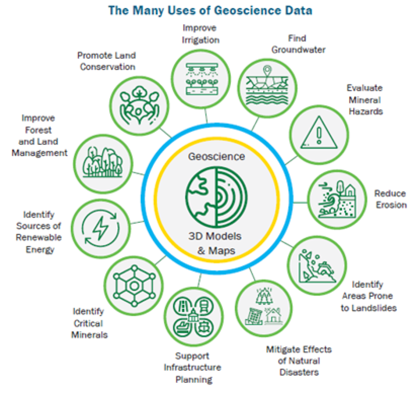 New geophysical data gathered in the Salton Trough will help identify potential geothermal resources, as well as monitor earthquake and flood hazards, groundwater, conservation areas, and mineral deposits, including lithium.
- Lithium is a valuable resource crucial to domestic high-tech manufacturing, especially for electric vehicle and grid storage batteries and components.
- As a ‘critical mineral,’ lithium has been identified as essential to the economic and national security of the United States.
GeoFlight is part of GTO’s Hydrothermal Resources program. Learn more about other hydrothermal efforts and GTO priorities.
The GTO e-newsletter brings funding opportunities, events, publications, & activities directly to your inbox.