
Planned burns in Ohio and Missouri meant to mimic beneficial, naturally occurring fires
February 14, 2024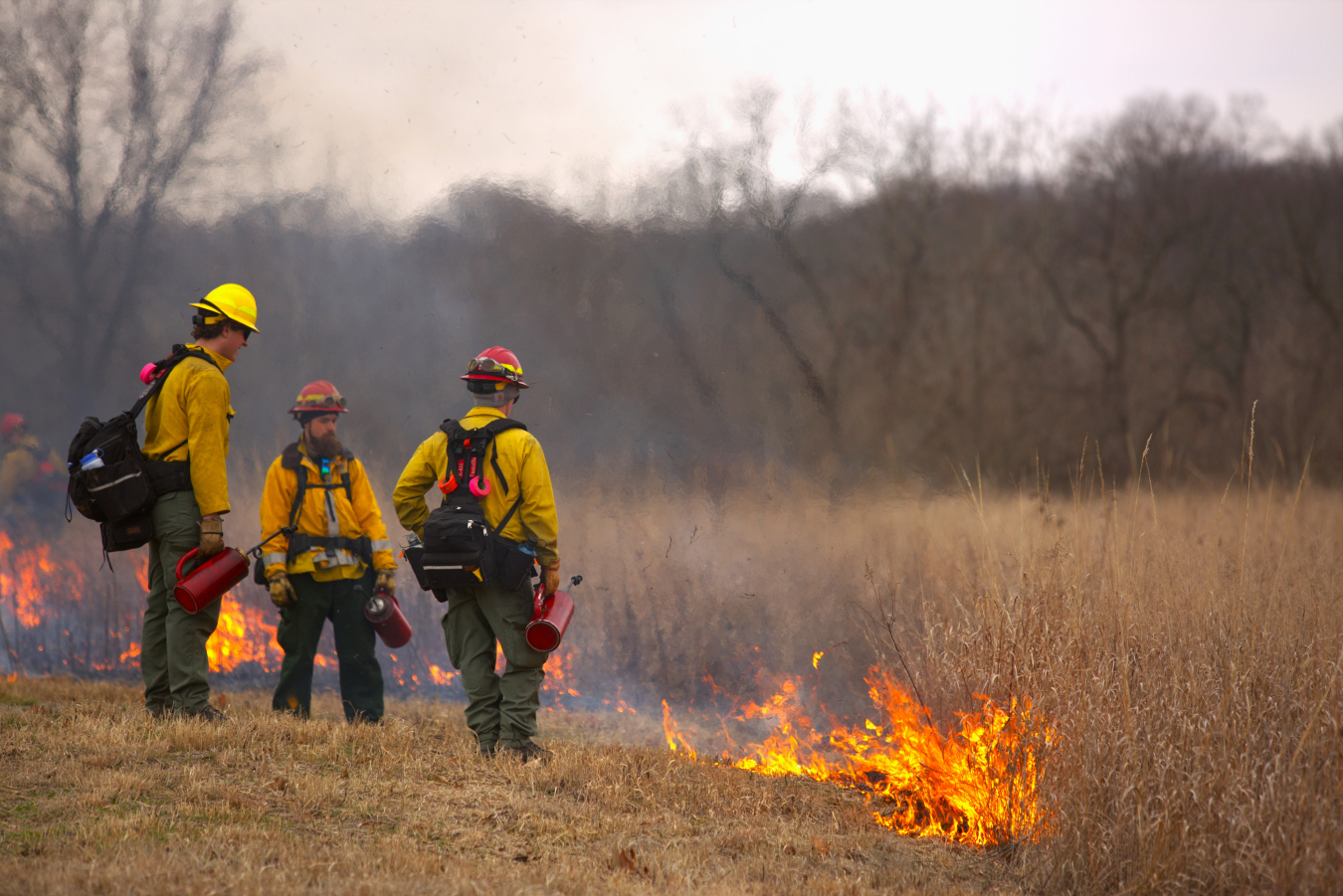
The U.S. Department of Energy Office of Legacy Management (DOE/LM) teamed up with specialists from the U.S. Forest Service (USFS), the Missouri Department of Conservation (MDC), and the National Weather Service (NWS) to carry out prescribed burns at the 153-acre Howell Prairie, which surrounds the disposal cell at the Weldon Spring Site, Missouri, as well as areas within the Fernald Preserve, Ohio, Site, near Cincinnati, the week of Jan. 31.
Prairie ecosystems are part of the landscape in Missouri and Ohio, particularly in the regions near the individual sites. Historically, Indigenous people burned prairies to support spring regrowth that attracted bison herds. This led to an ecosystem that needs fire to maintain biodiversity.
Prescribed burns prevent woody vegetation overgrowth and invasive species, and the nutrients released after the burn help rebuild the soil structure. The last prescribed burn at Howell Prairie was in 2018.
“We look out at the prairie now and see just a charred surface, and it is hard to understand how the burn was successful, but as spring arrives, we will start to see the natural recovery of the native prairie plants,” said Weldon Spring Site Manager Rebecca Roberts. “By this summer it will be difficult to tell that the area had been burned at all.”
The decision to restore the native prairies at the Weldon Spring Site and Fernald Preserve provides many benefits, including slowing runoff and reducing soil loss after heavy rainfall. Prairie root systems are immense, often reaching 15 to 20 feet underground. These root systems not only hold the soil surrounding the disposal cell in place, but the plants they support create a beautiful landscape for recreational activities.
Preparing to carry out a prescribed burn safely involves thorough planning from all partners to consider every small detail. The USFS partners from Wayne National Forest in Ohio visited the sites first. Their visits helped the burn boss create burn plans taking the topography, the fire’s proximity to sensitive areas, the preferred wind direction, weather factors, and access to the area into consideration. Understanding these factors helps ensure the burn plans are successful, meet management goals, and keep the public and burn crews safe.
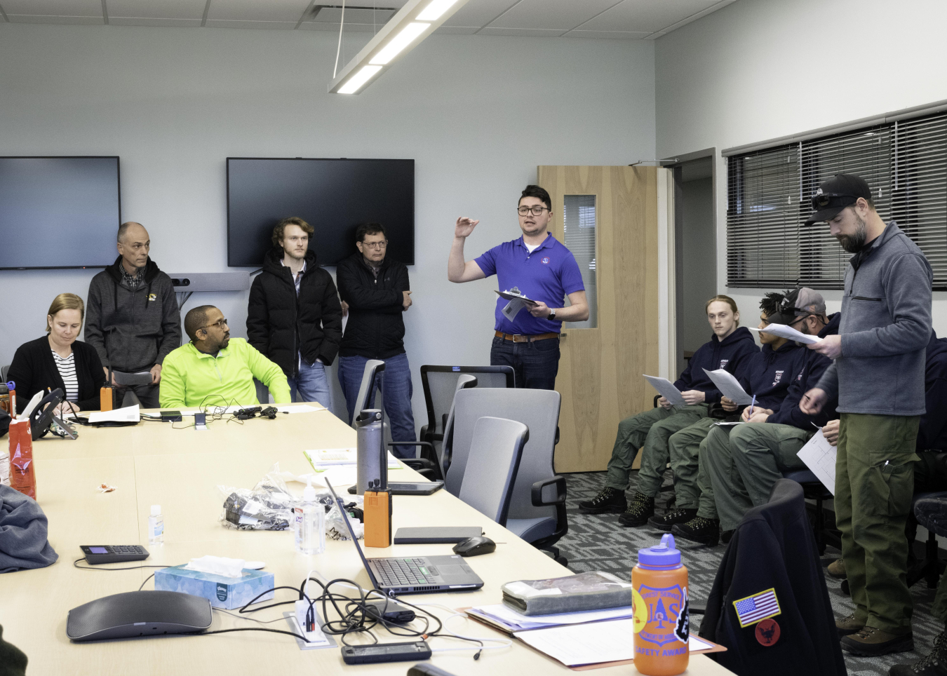
Matt Beitscher of the National Weather Service provides the spot weather forecast for the group before the burn on Jan. 31 at Weldon Spring Site. Site Manager Rebecca Roberts, left, and officials from the U.S. Forest Service, and National Weather Service discussed the plan in detail before the prescribed burn on the Howell Prairie.
The Weldon Spring Site borders two Missouri Department of Conservation areas — the August A. Busch Memorial Conservation Area and Weldon Spring Conservation Area. The 6-mile Hamburg Trail passes through the Weldon Spring Site and connects the two conservation areas. Weldon Spring Site employees worked with the teams to make sure proper road signage and trail closures were in place on the day of the prescribed burn to ensure public safety.
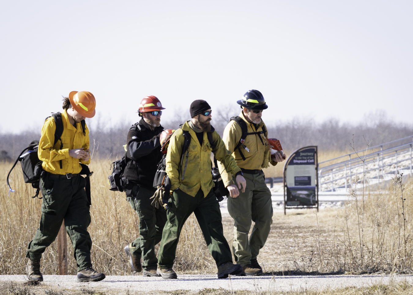
The day before the burn at the Weldon Spring Site, USFS specialists from Wayne National Forest and the Mingo Job Corps met to walk around the burn units and prepare for the burn. They also contacted the National Weather Service for a spot forecast — a forecast created for the site specifically for fire weather. The day of the burn, meteorologists from the Weldon Spring NWS office observed the burn to discover ways they could improve fire weather forecasting for other Missouri agencies that conduct prescribed burns.
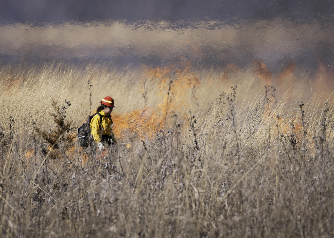
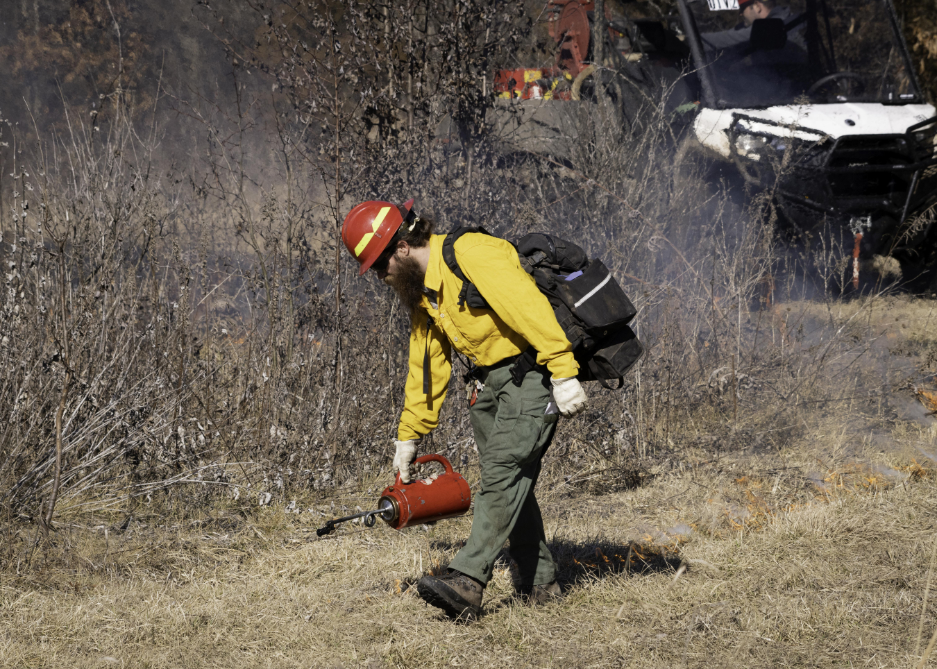
When weather conditions were favorable, around noon, the USFS started the burn at the Weldon Spring Site. LM Support Partners stationed at trail entry points kept the public from entering the area during the burn. Conditions were mild and crews worked slowly on the downwind side to make sure the burn was safe. As weather conditions improved, crews picked up the pace, and finished just after 5 p.m.
Immediately after the burn, USFS and LM held an after-action review to discuss the burn’s success, challenges, and corrective actions. The consensus among the group was that the burn was successful, and the partners expressed their excitement to return to the site and help with future prescribed burns.
Later that week, the same USFS crew visited the Fernald Preserve, Ohio, Site for the prescribed burn at that location. Their plan outlined a prescribed burn for 90-plus acres of prairie within the site. (Noting that up to 100 acres of prairie area can be burned per year at the Fernald site.)
The mid-morning test burn was successful, but during the main burn in the afternoon, the crew discovered that conditions were too wet in some areas. This resulted in a lower quality burn, so the crew was unable to complete the task. In total, crews were able to burn 30 acres at the prairies. The USFS will return at the end of February or early March to reassess conditions and perform another controlled burn on the remaining planned acreage.
“It takes an incredible amount of planning for the site and its partners to safely execute a prescribed burn,” said Fernald Preserve Site Manager Brian Zimmerman. “But the reward will be a healthy prairie that will continue to serve the site and the visitors for many years to come.”