
EM’s use of aerial drones at the Idaho National Laboratory (INL) Site is enabling cleanup contractor Idaho Environmental Coalition (IEC) to collect valuable data, protect workers and reduce costs.
Office of Environmental Management
December 19, 2023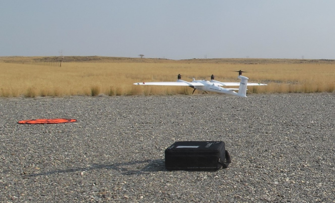
IDAHO FALLS, Idaho — EM’s use of aerial drones at the Idaho National Laboratory (INL) Site is enabling cleanup contractor Idaho Environmental Coalition (IEC) to collect valuable data, protect workers and reduce costs.
Between 2005 and 2019, crewed aerial flights and ground survey crews were the primary surveying tools for determining waste disposal project volumes, elevations and disposal heights of landfills. But contracting approved pilots and conducting ground surveys are costly and time intensive. The crewed flights alone cost EM around $20,000 a year.
To address these challenges, EM staff at the INL Site revolutionized their approach and introduced drones. In 2020, EM approved the purchase of two outdoor drones and created the Aerial Survey Drone Program.
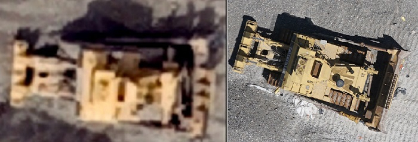
These images of a bulldozer at the Idaho Comprehensive Environmental Response, Compensation, and Liability Act Disposal Facility illustrate a difference in resolution between photographs taken by a crewed aerial survey and a drone. The drones not only produce sharper photographs, as shown in the image at right, they also capture more data used to generate highly detailed ground surface models.
The drones specialize in aerial photography, videography and remote sensing, which help produce photograph mosaic with embedded geographic references, 3D digital terrain models, surface contours and thermal imagery.
The impact of the flexible, consistent and accurate data produced by an in-house drone pilot was immediate.
High quality data have proven beneficial for a project to expand a portion of an INL Site landfill known as the Idaho Comprehensive Environmental Response, Compensation, and Liability Act Disposal Facility (ICDF).
Remote drone pilots capture photographs over the ICDF, which are then used to generate orthomosaic photographs, contours and digital terrain models of the landfill. In turn, the project can demonstrate elevation and disposal heights, and calculate remaining volume in the existing landfill, and use this data to plan for future disposal placement locations. The data collected from aerial surveys will also document the construction progress for other projects, such as the new ICDF Cell 3 landfill.
Transitioning from ground crews to aerial surveys protects workers from potential hazards in the field. IEC’s Environmental Restoration Program is also exploring the possibility of using drones to monitor vegetation restoration and conduct inspections at the disposal site for the Stationary Low-Power Reactor Number One nuclear reactor.
Other EM construction projects at the INL Site are interested in capturing orthogonal photography. At the Radioactive Waste Management Complex’s Accelerated Retrieval Project, aerial surveys can help as the project prepares for the construction of a cap over the landfill known as the Subsurface Disposal Area.
While still in its infancy, the Aerial Survey Drone Program is exploring other opportunities to support projects at the INL Site.
"As the program gains momentum, there is cause for optimism," said Dan Mahnami, the remote drone pilot and geographic information system analyst for IEC. "IEC is at the forefront of innovative work that is already enhancing cleanup work."
-Contributor: Carter Harrison
To receive the latest news and updates about the Office of Environment Management, submit your e-mail address.