
Public outreach included in effort to monitor conditions at disposal site in northwestern New Mexico.
February 10, 2022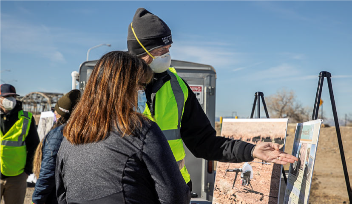
LM UMTRCA Program Manager Mark Kautsky provides information on the aerial survey at a public affairs kiosk in Nizhoni Park, New Mexico.
In January, the Office of Legacy Management (LM) conducted baseline aerial surveys to collect photogrammetry, lidar, and thermal data at the Shiprock, New Mexico, Disposal Site in a routine inspection for future monitoring of site conditions. Although the disposal site is in good condition, LM’s approach toward prudent site management is to establish an accurate baseline against which to monitor conditions as they change.
Shiprock is a Title I site under the Uranium Mill Tailings Radiation Controls Act (UMTRCA), which Congress established in 1978 to protect the public and environment from leftover contamination from former uranium-milling sites. Many of these sites, including the Shiprock site, were licensed to the U.S. Department of Energy (DOE) for cleanup, long-term stewardship, and routine maintenance.
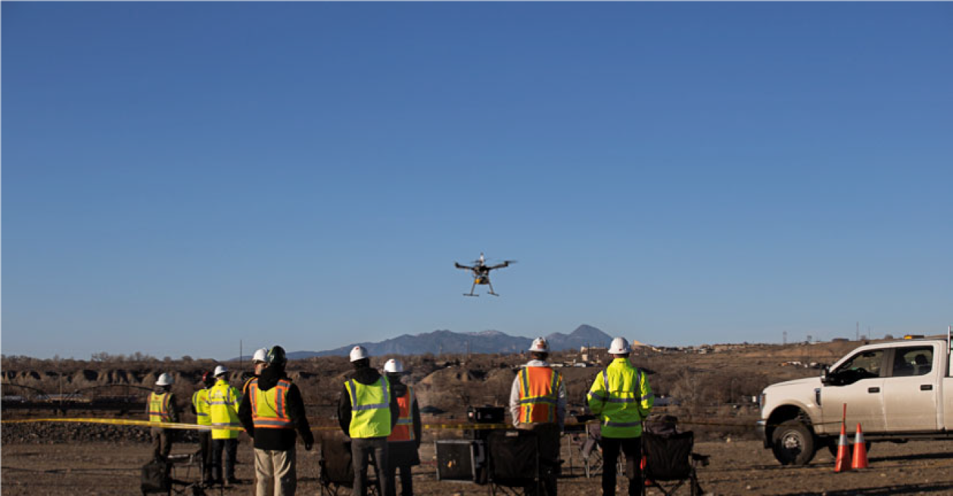
A drone takes flight to begin the baseline aerial survey at Shiprock, New Mexico.
Aerial surveys such as the one at Shiprock are conducted with drones, during daylight hours, to collect aerial imagery and topographic elevation data to provide LM with a high level of accurate data on the surface conditions.
“Drones are typically used because they are timesaving and provide more accurate, high-quality 3D spatial data that provides for in-depth reporting of the area,” said LM Program Aviation Manager Deborah Steckley.
While these surveys are conducted at 25 different UMTRCA Title I and Title II sites, the Shiprock survey offered a unique experience to members of the community.
“We were able to build an outreach campaign specific to the Shiprock community and our partners, which gave us the opportunity to not only address any concerns but also spread the word about why aerial surveys of the area are important,” said LM UMTRCA Program Manager Mark Kautsky. “This ensures that community members are aware of what’s going on and gives them an opportunity to be engaged in our stewardship projects.”
Since September, LM has been conducting outreach to engage the public, utilizing everything from local radio announcements on Navajo-language stations to providing updates to local government, businesses, and Navajo emergency services in the area. LM and Legacy Management Support (LMS) Public Affairs staff went door to door to hand out flyers that gave a brief overview of the project, with answers to questions people may have. These flyers were also distributed to homeowners who live near the disposal site, and in high-traffic areas such as grocery stores, post offices, and restaurants.
LM also informed the Shiprock Chapter House, Navajo Nation law enforcement, and coordinated outreach activities with the Navajo Nation Abandoned Mine Lands Department (AML). A video of Kautsky explaining the project and giving important background information on the survey was created to help visually demonstrate the project, and was shared with tribal partners. AML shared the video on its Facebook page to reach an even wider audience.
To spread the word of the project even further, LM staffed a public affairs kiosk at a local park where members of the community could address any questions or concerns directly with the aviation team.
“It’s imperative to involve the community in something like this and being able to interact with them and answer important questions,” Kautsky said. “We had several interested members, and even some interest from a local school. I look forward to being able to do more outreach projects like this in the future.”