
In celebration of National Aviation History Month, we recognize the U.S. Atomic Energy Commission (AEC) “rim flyers” program. Initiated in 1952, the program helped research and pinpoint more than 1,140 geological anomalies across the country.
November 3, 2021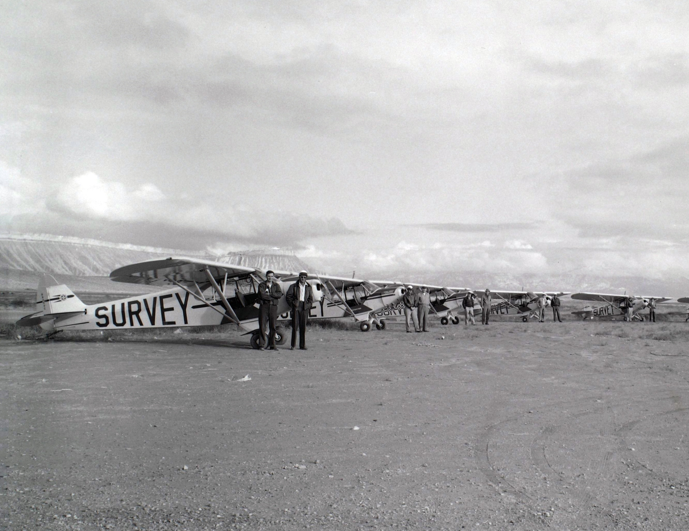
In 1952, the Atomic Energy Commission (AEC) formed an airplane program that flew over the Colorado Plateau to mark spots that might contain uranium for possible mining. Ten Piper Cub airplanes were crewed by a pilot and geologist and were equipped with gamma scintillation counters – instruments that detected radiation at a greater distance than a Geiger counter.
The crews known as “rim flyers” scanned more than 80,000 square miles of territory in just three years. After their reports were drafted, they were posted in public spaces throughout the West on the 15th day of every month. Members of the public would communicate the reports to colleagues in the field to try to stake a claim on the land. Legacy Management (LM) Historian Eric Boyle notes that according to a history of uranium development written by the Atomic Energy Commission in 1967, “during the peak of the uranium excitement, if an AEC rim flyer circled an area more than once it most likely would be staked, often in a matter of a few hours.”
With this program, the AEC created at least 197 maps that pinpointed an estimated 1,140 anomalies, suggesting potential uranium deposits across the Colorado Plateau, as well as several other locations in states such as Arkansas, California, South Dakota, Texas, Utah, and Wyoming. Most of these were developed into mines. As Boyle points out, “In the third volume of AEC history, written by Richard Hewlett and Jack Holl, the authors note that uranium mining on the Colorado Plateau at this time was reminiscent of gold-rush days. Intense exploration resulted in the discovery of huge uranium deposits where only scattered deposits had been found before.”
While the rim flyers could detect uranium from above, there was still the issue of getting access to the sites on the ground. Many of the roads on the Colorado Plateau were poorly constructed, could not handle excessive ore hauling, and, in certain seasons, were impossible to drive on.
AEC partnered with the Bureau of Public Roads, along with other state agencies, to rectify the situation, drawing plans to investigate and recommend improvements on the roads that needed the most urgent improvements. The results of those efforts opened many roads to uranium-producing areas. In total, more than 90 roads were repaired, costing about $13,620 per mile and covering more than 1,253 miles. This road program continued into the late 1950s and cost about $17 million, of which most of the funds came from AEC, and another $3 million from federal aid and state funds.
With the new gamma-detecting technology, rim flyers’ expanded exploration revealed uranium deposits more dispersed across the United States. The U.S. Geological Survey (USGS) supported AEC by assigning hundreds of geologists and other experts to search for these deposits. AEC geologists and mining engineers worked with USGS for several years and shared a compound in Grand Junction. A log cabin on the compound that served as the AEC’s office is now home to LM’s Atomic Legacy Cabin, which operates as a museum and education center, and offers STEM curricula and virtual programming at all grade levels.